Control surveys establish precise horizontal and vertical relationships of a network of monuments/markers which serve as the coordinate basis for additional surveys or
Constrol survey provides a framework of survey points, whose relative positions, in 2D or 3D, are known to specified degrees of accuracy
Project that require control surveys;
Requirements for network design of the control survey;
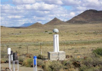
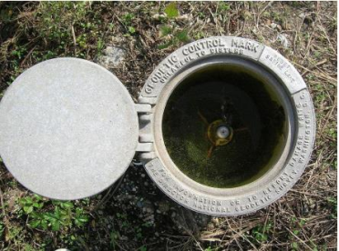
Consideration of monumentation of controls;
appropriate, secure, and stable,soil conditions,physical placement,stability concerns and,stability concerns and,All survey equipment used must be in adjusted working order with appropriate calibration
Observation procedures should be standardized and established
Quality assurance procedures must be followed to confirm the expected results
Processing of the measurement data is generally done through a network adjustment utilizing a practical observation weighting scheme through least squares
Report; background of the project, initial scope of the project, project objects, the survey methodology utilized, the field measurements made, the analysis and results of the survey ( including accuracy statements) and conclusions/recommendations from the control survey
Survey equipments that can be utilized;
The methods used for control surveys are
There 2 approaches; pre vs. post control surveys
Depend with the personal preferences
Project timeframe
Surveying with GNSS equipment has many advantages over conventional survey methods
Using GNSS equipment also has several disadvantages
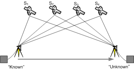
A static network is made up of multiple GNSS receivers collecting data over multiple GNSS sessions
Static observations typically range from 30 to 120 minutes depending on the distance
The data from these observations are post-processed with proprietary GNSS software using the least-squares method of adjustment
The longest baseline in the GNSS session is used to determine the collection time
e.g. 10 km = 20 minutes collection time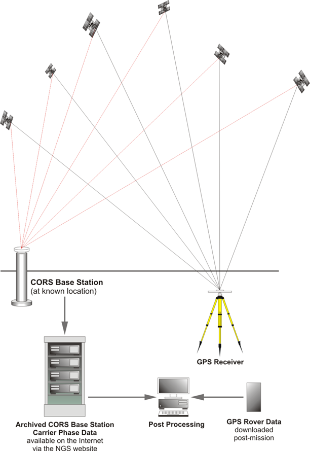
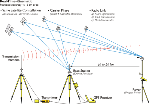
Real-time kinematic (RTK) method is a radial survey that utilizes two or more GNSS receivers
RTK method does not require the data to be post-processed; thereby allows the user to obtain coordinates in real-time
RTK method measure baselines from the base station to the rover by a radio data link
What is RTK Initialization? & why is it important?
What is Site calibration/Localization? & why is it important?
Reference data sources - CORs
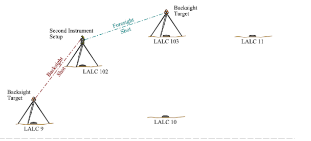
Conventional surveying methods;
Traversing/Resection with traverse adjustment
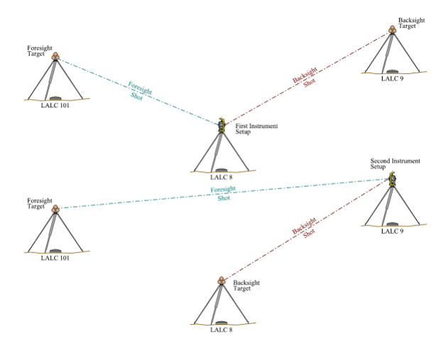
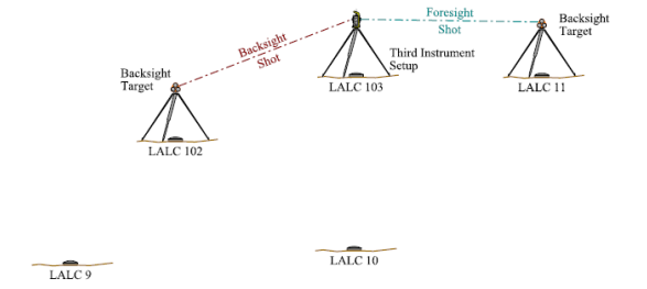
Conventional surveying methods;
Traversing/Resection with traverse adjustment
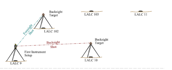
Conventional surveying methods;
Traversing/Resection with traverse adjustment
Conventional surveying methods;
Traversing/Resection with traverse adjustment

Assignment 3
Queries about this Session, please send them to:
*References*
- American Society of Civil Engineers, 2000
- The surveying handbook. 2nd Edition. Springer, 1995,
Brinker, R. C. and Minnick, R.- Kenya Survey Manual
SOK- Land Surveyor Reference Manual
Andrew L. Harbin
Courtesy of Open School